Detection of dryland forest through spectral signatures generalization
DOI:
https://doi.org/10.25260/EA.25.35.2.0.2518Keywords:
open woodland, satellite images, Landsat, Random Forest, Support Vector MachineAbstract
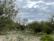
Dryland forests are among the most threatened and least studied forests in the world. Their detection and monitoring using medium-resolution satellite imagery present limitations derived from their naturally open structure. Therefore, methodologies incorporating information from very high-resolution images have been proposed, though these are compromised by the low availability of such imagery in some regions. This work aims to evaluate the feasibility of implementing spectral signature generalization to support multitemporal detection of dryland forests, taking a carob forest in Mendoza (Argentina) as a case study. This approach uses spectral signatures from images obtained on dates different from those classified. Signature generalization was compared with the traditional approach (i.e., using signatures only from the date under analysis). For each of the three dates studied, nine types of classifications were evaluated, varying 1) the addition or absence of a spectral index to the mosaic being classified; 2) the classification scheme; and 3) the classifier. Error matrices were constructed, and map accuracy metrics were calculated. The overall accuracy of classifications based on spectral signature generalization was equal to or greater than that of classifications performed using signatures from the analyzed date. Be�er results were obtained for classification types by implementing a simple classification scheme (two categories: forest and non-forest) and using Random Forest. The evaluated methodology constitutes a valuable contribution to designing strategies for efficient remote monitoring of these types of forests, particularly bec ause it can be implemented on dates and in regions with insufficient numbers of high-resolution samples for classification and map validation, or where these data are highly spatially concentrated.
References
Abraham, E. M., H. F. del Valle, F. Roig, L. Torres, J. O. Ares, F. Coronato, and R. Godagnone. 2009. Overview of the geography of the Monte Desert Biome (Argentina). Journal of Arid Environments 73:144-153. https://doi.org/10.1016/j.jaridenv.2008.09.028.
Adugna, T., W. Xu, and J. Fan. 2022. Comparison of Random Forest and Support Vector Machine classifiers for regional land cover mapping using coarse resolution FY-3C images. Remote Sensing 14:574. https://doi.org/10.3390/rs14030574.
Bastin, J.-F., N. Berrahmouni, A. Grainger, D. Maniatis, D. Mollicone, R. Moore, C. Patriarca, et al. 2017. The extent of forest in dryland biomes. Science 356:635-638. https://doi.org/10.1126/science.aam6527.
Bey, A., A. S. P. Díaz, D. Maniatis, G. Marchi, D. Mollicone, S. Ricci, J. F. Bastin, R. Moore, S. Federici, et al. 2016. Collect Earth: Land use and land cover assessment through augmented visual interpretation. Remote Sensing 8:1-24. https://doi.org/10.3390/rs8100807.
Carreiras, J. M. B., J. M. C. Pereira, and J. S. Pereira. 2006. Estimation of tree canopy cover in evergreen oak woodlands using remote sensing. Forest Ecology and Management 223:45-53. https://doi.org/10.1016/j.foreco.2005.10.056.
Cesca, E. M. 2011. Influencia del fuego en la estructura y dinámica de los algarrobales del sudeste de Mendoza. Tesis de doctorado, Universidad Nacional de Córdoba.
COFEMA. 2012. Resolución 230/12 Aprobación de documento elaborado por técnicos y autoridades provinciales de bosques nativos. URL: tinyurl.com/2s3f49ez.
Congalton, R. G. 1991. A review of assessing the accuracy of classifications of remotely sensed data. Remote Sensing of Environment 37:35-46. https://doi.org/10.1016/0034-4257(91)90048-B.
European Commission. 2015. Land Cover 2015-2019 (raster 100 m), global, annual - version 3. URL: tinyurl.com/3sywk866.
Fagan, M. E. 2020. A lesson unlearned? Underestimating tree cover in drylands biases global restoration maps. Global Change Biology 26:4679-4690. https://doi.org/10.1111/gcb.15187.
FAO. 2019. Trees, forests and land use in drylands: the first global assessment. Full report. Rome.
FAO, and UNEP. 2020. The state of the world’s forests 2020. Forests, biodiversity and people. Page The State of the World’s Forests 2020. FAO and UNEP, Rome.
Global Forest Watch. n.d. Forest Watcher. URL: tinyurl.com/4eb8zk46.
Goirán, S. B., J. N. Aranibar, and M. L. Gómez. 2012. Heterogeneous spatial distribution of traditional livestock settlements and their effects on vegetation cover in arid groundwater coupled ecosystems in the Monte Desert (Argentina). Journal of Arid Environments 87:188-197. https://doi.org/10.1016/j.jaridenv.2012.07.011.
Gorelick, N., M. Hancher, M. Dixon, S. Ilyushchenko, D. Thau, and R. Moore. 2017. Google Earth Engine: Planetary-scale geospatial analysis for everyone. Remote Sensing of Environment 202:18-27. https://doi.org/10.1016/j.rse.2017.06.031.
Guida-Johnson, B., P. E. Villagra, L. M. Alvarez, F. Rojas, and J. A. Alvarez. 2021. Finding woodlands in drylands: Bases for the monitoring of xeric open forests in a cloud computing platform. Remote Sensing Applications: Society and Environment 22:100528. https://doi.org/10.1016/j.rsase.2021.100528.
Hansen, M. C. C., P. V Potapov, R. Moore, M. Hancher, S. A. a Turubanova, A. Tyukavina, D. Thau, et al. 2013. High-resolution global maps of 21st-century forest cover change. Science 342:850-854. https://doi.org/10.1126/science.1244693.
Koutroulis, A. G. 2019. Dryland changes under different levels of global warming. Science of the Total Environment 655:482-511. https://doi.org/10.1016/j.scitotenv.2018.11.215.
Lesiv, M., L. See, J. C. L. Bayas, T. Sturn, D. Schepaschenko, M. Karner, I. Moorthy, I. McCallum, and S. Fritz. 2018. Characterizing the spatial and temporal availability of very high resolution satellite imagery in Google Earth and Microsoft Bing Maps as a source of reference data. Land 7. https://doi.org/10.3390/land7040118.
Martínez Pastur, G., M. M. Amoroso, G. Baldi, M. D. Barrera, A. D. Brown, L. M. Chauchard, L. Galetto, et al. 2023. ¿Qué es un bosque nativo en la Argentina? Marco conceptual para una correcta definición de acuerdo con las políticas institucionales nacionales y el conocimiento científico disponible. Ecología Austral 33:152-169. https://doi.org/10.25260/EA.23.33.1.0.2040.
Miles, L., A. C. Newton, R. S. DeFries, C. Ravilious, I. May, S. Blyth, V. Kapos, and J. E. Gordon. 2006. A global overview of the conservation status of tropical dry forests. Journal of Biogeography 33:491-505. https://doi.org/10.1111/j.1365-2699.2005.01424.x.
ONDTyD. n.d. Índice de Aridez (según UNEP, en porcentaje de la superficie nacional).
Pax-Lenney, M., C. E. Woodcock, and S. A. Macomber. 2001. Forest mapping with a generalized classifier and Landsat TM data. Remote Sensing of Environment 77:241-250. https://doi.org/10.1016/S0034-4257(01)00208-5.
Proyecto MapBiomas Argentina. 2024a. Colección 1. Mapa anual de cobertura y uso del suelo en Argentina correspondiente al año 2013.URL: tinyurl.com/57x2c23t.
Proyecto MapBiomas Argentina. 2024b. Colección 1. Mapa anual de cobertura y uso del suelo en Argentina correspondiente al año 2019. URL: tinyurl.com/3dmfwxz9.
Reynolds, J. F., D. Mark, S. Smith, E. F. Lambin, B. L. T. Ii, M. Mortimore, S. P. J. Batterbury, T. E. Downing, et al. 2007. Global desertification: Building a science for dryland development. Science 316:847-851. https://doi.org/10.1126/science.1131634.
Sexton, J. O., P. Noojipady, X. P. Song, M. Feng, D. X. Song, D. H. Kim, A. Anand, C. Huang, S. Channan, S. L. Pimm, and J. R. Townshend. 2016. Conservation policy and the measurement of forests. Nature Climate Change 6:192-196. https://doi.org/10.1038/nclimate2816.
Sexton, J. O., D. L. Urban, M. J. Donohue, and C. Song. 2013. Long-term land cover dynamics by multi-temporal classification across the Landsat-5 record. Remote Sensing of Environment 128:246-258. https://doi.org/10.1016/j.rse.2012.10.010.
Strahler, A. H., L. Boschetti, G. M. Foody, M. A. Friedl, M. C. Hansen, M. Herold, P. Mayaux, J. T. Morisette, S. V. Stehman, and C. E. Woodcock. 2006. Global land cover validation: Recommendations for evaluation and accuracy assessment of global land cover maps. Ispra.
Sunderland, T., D. Apgaua, C. Baldauf, R. Blackie, C. Colfer, A. B. Cunningham, K. Dexter, H. Djoudi, D. Gautier, et al. 2015. Global dry forests: A prologue. International Forestry Review 17:1-9. https://doi.org/10.1505/146554815815834813.
UNCCD. 2012. Desertification: a visual synthesis. URL: tinyurl.com/tt36n5rm.
Villagra, P. E. 2000. Aspectos ecológicos de los algarrobales argentinos. Multequina 9:35-51.
Villagra, P. E., and J. A. Alvarez. 2019. Determinantes ambientales y desafíos para el ordenamiento forestal sustentable en los algarrobales del Monte, Argentina. Ecología Austral 29:146-155. https://doi.org/10.25260/EA.19.29.1.0.752.
Villagra, P. E., M. A. Cony, N. G. Mantován, B. E. Rossi, M. M. González Loyarte, R. Villalba, and L. Marone. 2004. Ecología y manejo de los algarrobales de la Provincia Fitogeográfica del Monte. En J. F. Goya, J. L. Frangi and M. F. Arturi (eds.). Ecología y manejo de los bosques de Argentina. Investigación en bosques nativos de Argentina. Editorial de la Universidad Nacional de La Plata (EDULP).
Woodcock, C. E., S. A. Macomber, M. Pax-Lenney, and W. B. Cohen. 2001. Monitoring large areas for forest change using Landsat: Generalization across space, time and Landsat sensors. Remote Sensing of the Environment 78:194-203. https://doi.org/10.1016/S0034-4257(01)00259-0.
Young, N. E., R. S. Anderson, S. M. Chignell, A. G. Vorster, R. Lawrence, and P. H. Evangelista. 2017. A survival guide to Landsat preprocessing. Ecology 98:920-932. https://doi.org/10.1002/ecy.1730.
Downloads
Additional Files
Published
How to Cite
Issue
Section
License
Copyright (c) 2025 Bárbara Guida-Johnson, María A. Aranda

This work is licensed under a Creative Commons Attribution 4.0 International License.
Authors retain their rights as follows: 1) by granting the journal the right to its first publication, and 2) by registering the published article with a Creative Commons Attribution License (CC-BY 4.0), which allows authors and third parties to view and use it as long as they clearly mention its origin (citation or reference, including authorship and first publication in this journal). Authors can make other non-exclusive distribution agreements as long as they clearly indicate their origin and are encouraged to widely share and disseminate the published version of their work.